
Summary
A proper hill walk to the summit of a proper Ayrshire hill. This circular route offers variety by returning via the old Muirkirk to Sanquhar drover's road. The walk is relatively straightforward but there is a very boggy section on the approach, over which progress is aided by some boardwalks and new pathwork.


Terrain
Grass/earth footpaths and good aggregate tracks; some boggy sections.
Getting there
Start
Walkers' Car Park, Kames.
Public Transport
None to start - Bus routes 46 from Cumnock/Ayr and X76 from Glasgow stop at Muirkirk, 1km from Kames/start.
Start Grid Ref
NS696264
Summits Climbed
- Sub 2000
- Cairn Table

Stage 1
Begin from the car park adjacent to the Kames Institute; an information board shows the route but the colours used on the map don't necessarily match those shown on the route waymarkers. Continue past the board and ignore the paths forking right to begin a short ascent to a gate with adjacent stile.

Stage 2
Cross the stile to enter an expanse of farmland dotted with relics of the area's industrial past. Evidence of lead, coal and iron ore mining can be observed, along with traces of an aggregate path beneath the grass. The path quickly degenerates as it winds over and around the many springs emerging from the northwest slopes of Cairn Table. Water from one of these springs - Cairntable Cauldron - is rumoured to have been in demand by the Picts to create a heather-based homebrew.

Stage 3
A series of wooden duckboards, new path sections and bridges have been installed to ease progress over the worst of the mud Pass through a kissing gate and follow the path alongside a fence and drystane dyke known locally as the March Fence. As the gradient begins to steepen the path begins to get rockier as the spur named The Steel is reached. From this 413m spot height it's a short, sharp climb beyond to reach a path junction below the Cairn Table summit - either turn left to take the slow, gradual track or carry straight on to cross a small bridge and ascend via a narrower, rough footpath.

Stage 4
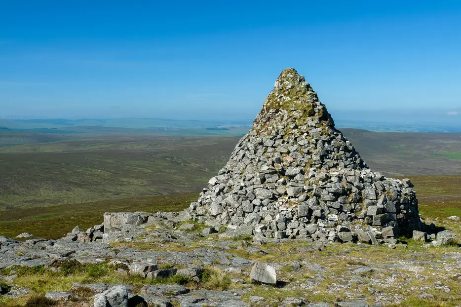
Regardless of route, the rocky (and somewhat crowded) 593m summit is soon reached, topped with a huge cairn, triangulation pillar and direction indicator. The large cairn was built in 1920 in memory of local men and women who were killed or served in the Great War. Further east are the remains of two prehistoric cairns, one which has been severely depleted to provide building material for the memorial and is now topped by the trig pillar, and one beyond which is relatively undisturbed. The views from the summit are extensive, with the Isle of Arran often visible on the western horizon and Ben Lomond to the north.

Stage 5
Descend to the path junction and take the left fork to descend roughly west across the grouse moorland. In August the purple heather bloom is particularly stunning, and a haven for birds such as hen harrier, curlew and lapwing. This narrower path is rougher and less eroded than the ascent route but nonetheless easy going, with ample opportunity to enjoy the views over Garpel Water before descending to the old drove road to Sanquhar.

Stage 6
Turn right to follow the track towards Kames. It passes a monument to John Loudon McAdam - the road builder after whom tarmacadam was named - and the ruins of his house at Springhill. Continue along the track until it returns to Kames, then then right along the tarmac road past the fine old Institute building to return to the start.

Route Profile
